By Molly Moore
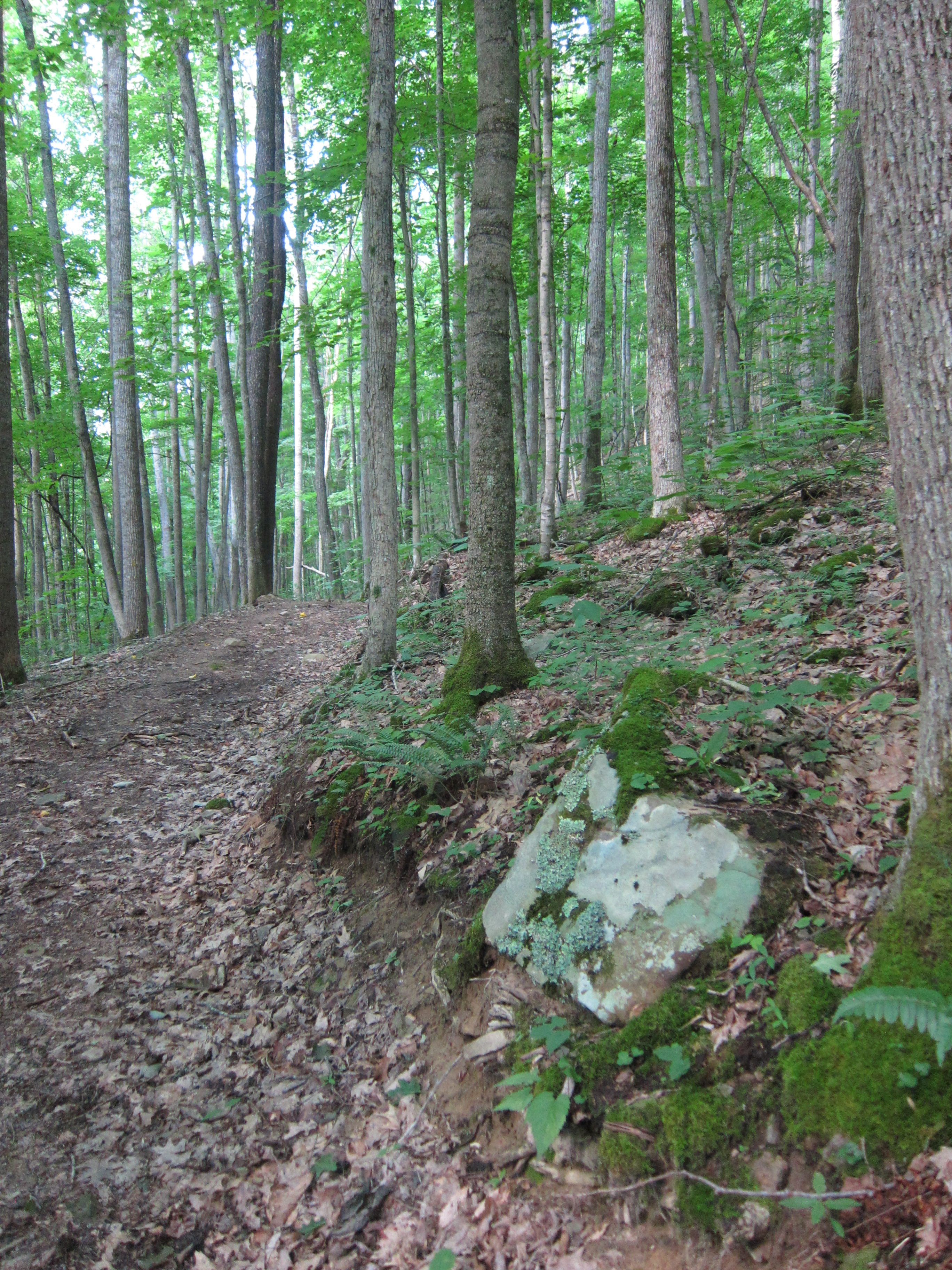
A shaded section of the Farley Ridge Road & Trail at Camp Creek State Park.
Just two miles away from busy Interstate 77, visitors to West Virginia’s Camp Creek State Park trade the hum of passing traffic for birdsong and the rushing chatter of waterfalls.
“As soon as you come through the mountains and to the park, you enter a very vast, remote part of the country here, just a beautiful, vast forest with lots of things to do,” says Park Superintendent Frank Ratcliffe.
Convenient access to the interstate makes the park a handy stopover for travelers, and the broad range of recreational options marks it as a destination in its own right. The park is open year-round, and visitors can hike, fish, hunt, splash in the creek or bring their horses and mountain bikes. Of the roughly 36 miles of trails, about six miles are for hiking only, while the others are also open to equestrian and bike use.
The 5,500-acre Camp Creek State Forest abuts the 500-acre state park, giving the park’s trail system more room to roam and providing access to public hunting areas. The park and forest also include two creeks, where anglers can find ample trout in winter and early spring, and might even catch enough trout in midsummer for a hearty dinner.
The camping facilities also reflect the park’s broad appeal. Accommodations range from a modern campground outfitted with wi-fi to rustic camping, a horse-friendly campground and a new backcountry site. The latter two are the only horse and backcountry camping areas in the West Virginia state park system.
Double C Campground, the creekside camping area shared by hooved explorers and their riders, provides access to 25 miles of horse trails and cements Camp Creek’s place as an equestrian jewel.
Similarly, Ratcliffe hopes to draw more mountain bikers to the park with a new backcountry campsite. The site is tucked near the center of the park’s trail system, three miles from the main office parking area along a new path, Almost Heaven Road and Trail, named for its scenic views of the Allegheny mountain range. From here, mountain bikers of all levels can devise their own routes.
For those who prefer a refreshing mountain stream, Campbell Waterfalls and Mash Fork Waterfalls are popular wading areas and are both a short jaunt along the Turkey Loop Road and Trail from the park’s two main campgrounds.
Mash Fork Magic
Hikers looking for a more secluded journey to Mash Fork Waterfalls can link to hiking-only footpaths from the multi-use paths marked “road and trail.” One invigorating foray combines Farley Ridge Road and Trail with the Mash Fork Trail for a 1.6 mile loop that’s more challenging than its mileage suggests.
From the main office parking area, hikers follow the Farley Ridge Road and Trail as it climbs uphill — sometimes steadily, sometimes abruptly. The trail’s shade eases the strain of elevation gain, and the surrounding forest sports an array of rainbow-hued mushrooms and seasonal wildflowers. Look for trillium and columbine in spring, admire rhododendron blossoms around the 4th of July, find bright red cardinal flowers along the creek in late summer, and keep an eye out for asters in fall.
After .6 miles on Farley Ridge, the trail meets the hiking-only Mash Fork Trail. The intersection evokes Robert Frost’s reference to “the path less traveled,” with the narrow dirt path to the left breaking off from the wide gravel one.
On this seemingly less-traveled path, the Mash Fork Trail descends a series of switchbacks for 1.1 miles, gradually becoming steeper until it reaches the waterfall. Those who continue on Farley Ridge Road and Trail will soon reach the namesake ridge, which the path follows for about two relatively level miles before intersecting Almost Heaven Road and Trail.
Hikers who trek to the falls will be greeted with the sight of Mash Fork Creek tumbling off a broad rock ledge. The falls form a captivating cascade when the water level is high and spill across the mossy stone in several smaller fountains when the stream is shallow. Below, a wide pool provides an opportunity to dip trail-weary feet.

Visitors can reach Mash Fork Waterfalls by an easily accessible route or a challenging hike. Photo courtesy WVExplorer.com
From the waterfall, return to the parking area without stepping on asphalt by turning left on a short section of Turkey Loop Road and Trail and taking another left on a brief section of the horse bypass trail.
This Mash Fork loop offers a taste of the possibilities at Camp Creek State Park and Forest, but visitors needn’t stop at the parking area — there are many more miles to discover.
Related Articles
Latest News
More Stories


Leave a comment
Your email address will not be published. Required fields are marked *