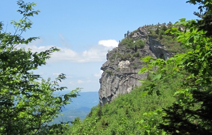
Midway up the Profile Trail, hikers can see the cliffside profile that gave Grandfather Mountain its name. Photo by Maeve Gould
Approaching by foot or car from any angle, the jagged contour and rocky peaks of Grandfather Mountain are distinct.
Although the landmark mountain was beset by intensive logging from 1916 through the 1930s, it is now remarkably well-conserved. The land falls under the purview of the Blue Ridge Parkway, Pisgah National Forest, Grandfather Mountain Stewardship Foundation, Grandfather Mountain State Park and private land trusts.
The Profile Trail begins on the mountain’s western slope at the state park. Its well-earned reputation as a classic North Carolina High Country hike stems from the trail’s sweeping views, its route through a wide range of natural communities and a memorably strenuous ascent.
Profile Trail
Length: Profile Trail is 3.6 miles one way; taking Grandfather Trail to Calloway Peak adds 0.4 miles each way.
Difficulty: Strenuous
Be Prepared: Wear sturdy footwear. Temperatures drop sharply from base to summit and precipitation is common; bring rain gear. Dogs may have difficulty with the ladders on Grandfather Trail. Bring a flashlight in case your hike takes longer than intended. In winter, expect snow and ice even if there is none in the valley.
Directions: From Boone, N.C., take N.C. Hwy 105 south 11.3 miles; turn left on The Glens Blvd for .7 miles to parking area.
Contact: (828) 963-9522 or ncparks.gov/grandfather-mountain-state-park
With roughly 2,000 feet of elevation gain from the trailhead to Calloway Peak, it is typically 10 to 20 degrees cooler at the top than at the mountain’s base. On a hot summer day, hikers are rewarded with cooler air and refreshing breezes on the ridgeline.
The journey starts at an access parking area constructed in 2017 where hikers can fill out a required free permit. Visitors begin by following a relatively flat footpath that winds through rhododendron thickets and fern-laden cove forest along Grandfather’s base.
Eventually, the trail draws alongside and then crosses the Watauga River, which parallels N.C. Highway 105. The Watauga is narrow and lively here, providing a pleasant alternative to the sound of the road beyond. Unless water levels are unusually high, the crossing should be simple. After passing by large boulders flanking the river, the trail turns up into the forest, gradually gaining in elevation as it passes under a hardwood canopy.
Hikers reach Foscoe View, the first notable overlook, at 2.2 miles. A bench offers respite while a sign points out the peaks beyond the community of Foscoe in the foreground. At this point, the upward climb becomes more pronounced, mounting stone steps and switchbacks toward a charming trailside campsite. Campers in Grandfather Mountain State Park must reserve sites in advance, pay a fee and fill out an on-site permit at the trailhead.
The subtle changes in ecosystem become more evident beyond the campsite, as more red spruce, yellow birch and mountain maple appear and the forest grows damper, with lush beds of moss clinging to stones and logs. But the footpath is not as wet as its surroundings; this section’s well-built stone trail was constructed in the late ‘80s by the private Grandfather Mountain attraction. Stay on the path to protect endangered plants nearby.
At 2.7 miles, a sign on the right points to a gap in the trees and the striking Profile View, a cliff face that resembles the side view of an older man’s face. This feature is rumored to be the true reason behind Grandfather Mountain’s name.
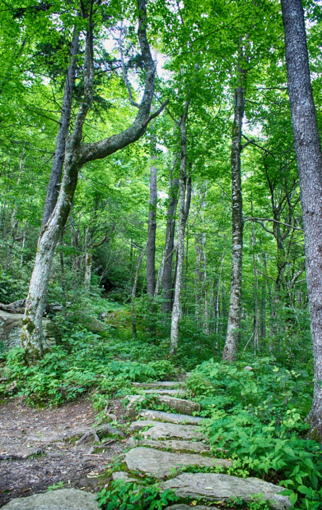
Stone steps pave part of the hike. Photo by Jimmy Davidson
Beyond Shanty Springs, hikers navigate an arduous incline strewn with rocks and roots for a third of a mile. The Profile Trail levels out for a stretch, and then, almost unexpectedly, ends at its junction with the blue-blazed Grandfather Trail. This area is often thick with summer wildflowers, which usually bloom a few weeks later than their valley counterparts.
Turn right onto the Grandfather Trail and you’ll experience the most rugged section of the mountain, climbing ladders and walking along exposed cliffs to pass landmarks such as Indian House Cave, Attic Window Peak and MacRae Peak. Follow this path roughly two miles to reach the Swinging Bridge maintained by Grandfather Mountain Stewardship Foundation. Hiking into the travel attraction and conservation education center is free, but driving in costs $22 for adults. You can opt to park a car here to facilitate a one-way trip, or hike in and out.
Alternatively, turn left onto Grandfather Trail and hike 0.4 miles toward Calloway Peak. This area is home to rare Fraser-fir-dominant forest that is only found in Western North Carolina, East Tennessee and Southwest Virginia on a handful of mountains over 5,500 feet, according to Grandfather State Park Ranger Luke Appling.
Hikers scale three short wooden ladders to reach Calloway Peak at 5,964 feet. This could mark the hike’s terminus — or hikers can continue to the other side of the mountain alongside the Blue Ridge Parkway by descending on the challenging Daniel Boone Scout Trail.
In clear weather, you can lounge on the flat rocks at Calloway Peak and gaze southeast toward the Blue Ridge Parkway and Pisgah National Forest — you’ll likely spot raptors riding the thermals below.
Related Articles
Latest News
More Stories

English Language Learning in Appalachia
Learning English is always difficult. But current aggressive approaches to immigration policy are creating more barriers for learners and the programs that serve them than ever before in Appalachia and beyond.

Pike County Rejects Mega Landfill
Many residents of Pike County, Kentucky, are breathing a sigh of relief since county commissioners finalized their decision to rescind a contract with an out-of-state waste management company.

Overdrive: Fossil Fuels in Appalachia
Electricity demand is on the rise. Here, we share snapshots of energy trends in the region and how methane gas, coal and data centers are affecting our communities — and how people are pushing back.

Less Support for Communities with Mine Problems
The Trump administration issued a regulation to weaken the Ten Day Notice process that helps community members call in federal enforcement when state regulators don’t do a good job policing environmental problems at coal mines

Chaos at the Tennessee Valley Authority, Cuts to Public Input
The past year has brought turmoil and uncertainty to the Tennessee Valley Authority, the nation’s largest public power provider, and its more than 10 million customers across the Tennessee Valley.

Landmark Coal Ash Protections Under Attack
The U.S. Environmental Protection Agency is planning to eviscerate important, hard-won regulations on coal ash, a toxic waste left after burning coal for energy.

Leave a comment
Your email address will not be published. Required fields are marked *
Leave a Comment