Finding Higher Ground From Floods
By Lorelei Goff
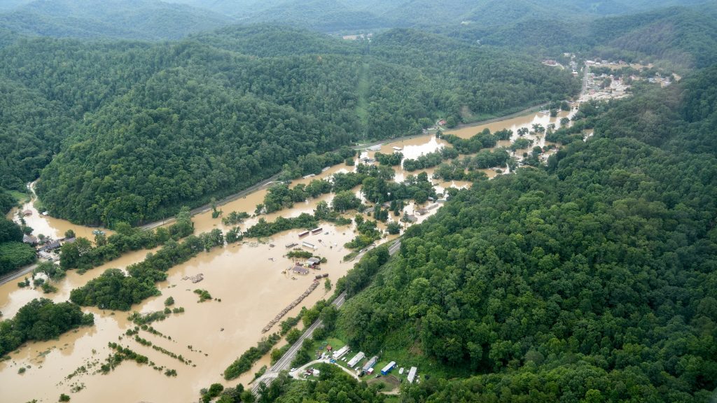
In the summer of 2022, the skies rained death and destruction on a swath of Central and Southern Appalachia, leaving 39 dead and causing billions of dollars in damage.
In Eastern Kentucky and Southwest Virginia, rain poured into the mountainous terrain at rates of up to four inches per hour and exceeded 16 inches total in some areas. Rivers and creeks swelled, washing away homes and parts of communities. Flash floods wiped out infrastructure for water, electricity, communications and transportation.
As catastrophic flooding events increase in frequency and severity, state governments, nonprofits and local communities have been diving into the questions surrounding flood recovery and mitigation.
Whether seeking solutions through repairing, rebuilding or relocating structures, or through planning and policy, a variety of private and public resources can provide the stepping stones to flood preparedness and recovery, helping communities minimize damage to people and infrastructure. But obstacles often hinder progress toward that goal.
Gimme shelter
Housing loss hits residents of rural, low-income communities in Appalachia especially hard. In the flooding that occurred from July 26 to 30, 2022, nearly 22,000 residents’ homes were damaged or destroyed. Of affected households, 44% included children or seniors. Six out of 10 of the affected households had incomes less than $30,000. Many homeowners were uninsured or underinsured, either due to income levels or because their property is located in floodplains and ineligible for flood insurance.
That’s the predicament in which Howard Baker and his neighbors on Buffalo Road in Owsley County, Kentucky, found themselves.
Baker awoke around 4 a.m. on July 28 to what he thought was the sound of knocking on his door. By the time he realized the sounds were coming from cars, trees and other debris hitting the side of his double-wide mobile home, the floodwaters burst through the outer wall. Unable to escape because of rising water outside, Baker sat down in a recliner as the water rose up to his waist. He estimates it peaked at about four feet inside his home.
When the waters receded, the garage and the porches on his home were gone, and he’d lost everything but his life. His insurance settlement fell far short of replacing his home. Underinsured, denied assistance by the Federal Emergency Management Administration and living in an area with a shortage of housing for sale or rent, Baker pondered how that would affect the rest of his life.
Days later, a Kentucky nonprofit called Partnership Housing, Inc. surveyed the damage in the area. They offered to relocate Baker to higher ground across the road and build a home for him.
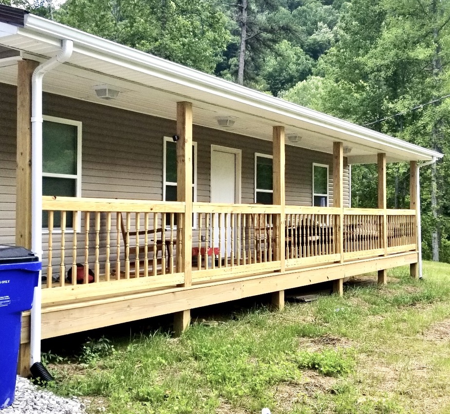
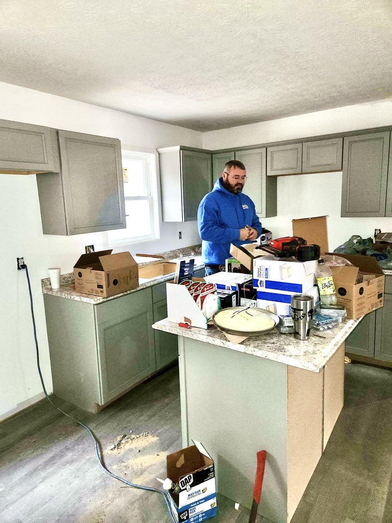
Partnership Housing, Inc. typically provides affordable housing for low- to middle-income families in the county, but they took on 15 home rehabilitations, one RV replacement and five new home builds specifically for flood survivors. All funds used directly for the flood recovery work came from private donations.
Executive Director Cassie Hudson says that while there needs to be some transitional housing to meet the need immediately following a disaster, there’s also a need for better long-term solutions, including rental units and new construction.
“There needs to be processes in place that help rehouse people, whether it’s more housing stock throughout the state or whether it’s the financial resources to get somebody housed,” she says. “People should not still be in travel campers and tents and things like that in a year out.”
The total number of people still seeking housing after the flood is unknown.
“One of the really frustrating things is that it’s hard to put a number on,” saysScott McReynolds of Housing Development Alliance, Inc., a nonprofit that assists rural Eastern Kentucky residents with low incomes in acquiring or repairing homes.
“We’re working with 150 to 200 families that need housing,” McReynolds says. He explains that people still without permanent, adequate housing since the flood may be in trailers provided by federal or state government, doubled up in homes of family members, housed in sheds or still staying in dangerously damaged houses.
“We’re almost a year out, and we get calls from people daily,” he says.
Kentucky’s Commonwealth Sheltering Program is still housing 82 households representing 213 individuals in travel trailer units or RVs, according to Jesse Elbouab, public information officer for Kentucky Emergency Management.
“We have seen the numbers continue to diminish every week as survivors work closely with case managers to identify and secure more long-term housing solutions,” Elbouab says. “When it comes to recovery, there is no ‘typical’ scenario. Everyone’s process, needs and time look very different.”
“The commonwealth will continue to shelter citizens until the need has been met,” she adds.
As of July 2023, an additional 94 survivors were still housed by the Federal Emergency Management Agency and were scheduled to lose eligibility for direct housing in January 2024.
“We have two new efforts in place to find suitable long-term housing solutions for Eastern Kentucky survivors, because of the tight rental and homeownership markets, and to get people out of flood risk areas,” says Kimberly Fuller at the FEMA Region 4 News Desk.
Patty Fugate with the Perry County Conservation District coordinates the USDA’s Natural Resources Conservation Service Emergency Watershed Protection Buyout Program for Breathitt, Knott, Letcher and Perry counties. The program offers buyouts at pre-flood value plus $31,000 to those who lost homes, incurred severe damage or are in the floodplain and in danger from future flooding.
As of July 5, 2023, the program had received 246 applications from four counties. Applications are still coming in and will be accepted through July 31.
“We are finding that a lot of people are just hearing about it,” Fugate says, adding that the agency will send postcards about the program to each address in the four counties.
The Army Corps of Engineers Section 202 Project is a flood risk management program that uses repair, relocation and buyouts to minimize further damage and loss of life in an approximately 5,500-square-mile area of Kentucky, Tennessee, Virginia and West Virginia affected by a 1977 flood. Properties eligible for the voluntary program include public facilities like schools and municipal buildings as well as private property like homes and businesses.
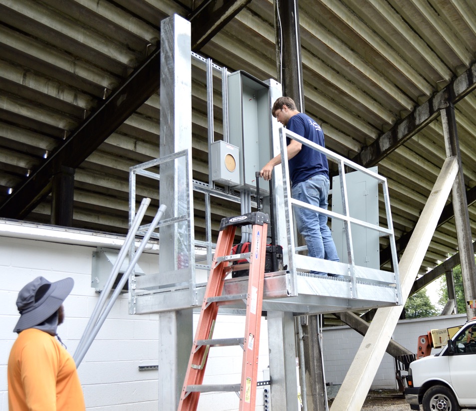
Pisgah High School football stadium in Canton, North Carolina, above the floodplain.
The system and football field were destroyed in a flood. Photo by Lorelei Goff
The Army Corps program was authorized by Congress in 1981 in response to the devastating 1977 flood in the Tug and Levisa Fork river basins, but it was unfunded until $235 million was appropriated from the roughly $700 million that funded the 2019 Disaster Relief Act. The application process for the program opened in 2000 and closed in June 2022. The Army Corps of Engineers re-opened the application window following Buchanan County’s July 2022 flooding, in the hope that more eligible homeowners might apply. Funds for accepted applications are released as each project is processed.
However, because the program’s eligibility requirements say an applicant’s house must be habitable, previously eligible homes that were destroyed in the 2022 flood lost their eligibility.
“That is a tragic situation, but I don’t know that there’s a way around that for us,” says Section 202 Program Manager Brandon Moore.
Some kinds of flood damage aren’t covered by housing resources. Rosa and James Underwood live on Jewell Valley Rd. in Buchanan County. While their house was undamaged by the 2022 Whitewood flood, the bridge across the creek in front of their home was destroyed, leaving them with no access to the road.
The couple, in their 70s, can’t afford the $20,000 replacement on their fixed income, and bridges, driveways and other structures apart from housing aren’t eligible for recovery resources through United Way or FEMA. Compounding the problem, State Farm Insurance told them their homeowners insurance would be dropped if the bridge wasn’t repaired by May 2024.
Charitable organizations are often the only recourse available to homeowners in such cases. A representative from Impact Missions, part of the Baptist General Association of Virginia, told the Underwoods in April that the group would replace the bridge for them. However, as of July 12, the one-year anniversary of the flood, they were still waiting for work to begin.
Where’s the money?
Adrienne Bush, executive director of the Housing and Homeless Coalition of Kentucky, points out that communication about available resources isn’t the only obstacle.
“There’s not enough funding available,” Bush says, noting that for disasters in the state during 2021, the need came to $110 million, but the federal relief funds allocated to the state came to $40 million, leaving a $70 million deficit.
Funding streams flow slowly after a disaster. The Kentucky legislature met a month after the 2022 flood but made no allocations due to concerns about duplicating FEMA funds and the capacity of housing developers to respond to such a massive need. Later, the Kentucky legislature created the Rural Housing Trust Fund to provide grants and loans for rural housing, including for those affected by the 2022 floods and 2021 tornados, and it allocated $20 million to the fund for fiscal year 2023-24.
“Part of the issue is FEMA comes in right after a disaster, there is some relief to the extent that people can get it, and then if your disaster is big enough — and the disasters in Kentucky in 2021 and 2022 were big enough — you get a special allocation from Congress and [theU.S. Department of Housing and UrbanDevelopment] for disaster recovery,”Bush explains. “But that program is not permanently authorized, and it takes a really long time for it to be deployed.So for the ‘21 disasters, that money is, as of a month ago, finally available two years later.”
The state should bridge the gap in timing and funds, Bush adds.
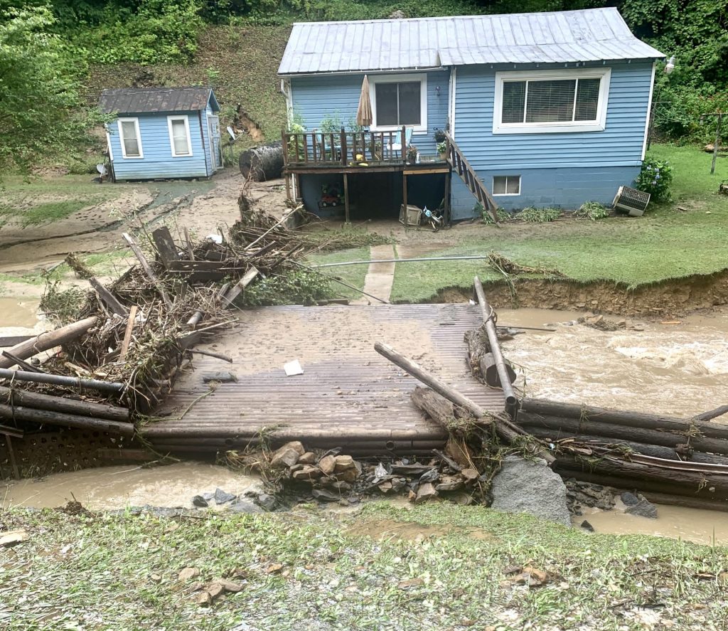
In the February 2023 Road to FloodDisaster Recovery report published by the nonprofit groups AppalachianCitizens’ Law Center and the Ohio RiverValley Institute, the estimated cost to address the damage to Kentucky homes by the 2022 flood ranges between $450- $950 million, depending on how many of the 542 homes destroyed and 4,500that sustained major damage are relocated, repaired or rebuilt.
After assessing the federal, state and philanthropic funds allocated to housing recovery after the flood, the report determined that only $409 million had been made available so far.
Bush, who feels FEMA’s disaster assistance is inadequate and not timely, advocates for the federal Disaster Survivors Fairness Act bill, which would simplify seeking disaster assistance, expand access to hazard mitigation assistance and ensure that FEMA funds are allocated to those with the greatest need. She’s also pushed for a permanent, flexible state fund that communities can use according to their specific needs for repair, relocation, rebuilding or increasing the number of rental units.
Jim King is the CEO of the nonprofit Federation of Appalachian Housing Enterprises, which works with more than 50 nonprofits across the region. He believes the long-term recovery process would benefit from legislation to establish permanent funds available when a disaster strikes. He also says that while investments in infrastructure are important, investing in relationships between nonprofits, communities and federal and state governments is also vital.
“If you want to talk about prevention or resilience, that long-term investment matters,” he says, explaining that the time to build a support network to turn to when disaster strikes is years before you need it.
“You have to know who you’re going to trust enough to pick up the phone and say, ‘Hey man, I’ve got trouble. I need help,’” he says.
According to the Road to Flood Disaster Recovery report, the region is ill-prepared to recover from or prepare for future extreme events due to factors including poverty, the national housing crisis and the crumbling coal industry.
“The last decade of decline in the coal mining industry has impacted public budgets and infrastructure and diminishes the capacity of local government response and mitigation,” the report’s authors write.
Large-scale land-disturbances like surface mines, clearcuts, and oil and gas activity can also increase the severity of floods and destabilize soil and rock. Denuded landscapes increase the volume and velocity of runoff and the potential for landslides. Increased runoff overwhelms unmaintained retention ponds and gullies. Felled trees and other debris wash into waterways, and water can build up behind them. When the volume of water causes those impoundments to break, huge, fast-moving waves rush downstream, sweeping away whatever, or whomever, is in their path.
Preparing for the storm
Other parts of the Appalachian Mountains also suffer the effects of increased precipitation and precipitation that falls in increasingly concentrated bursts, which can lead to flooding and landslides. These phenomena are driven by climate change. A study in the journal Water and corroborated by other research shows that over the last several decades, the region has become warmer and wetter.
As the atmosphere warms, its ability to hold water increases, which means more falls back to Earth when it rains. Compounding extreme precipitation events, periods of drought harden the ground, which makes it more impervious to water, further increasing the runoff.
In August 2021, the remnants of Tropical Storm Fred dropped more than 12 inches of rain on Haywood County, North Carolina, causing flash floods that killed six people.
Haywood County resident Rod Walters watched his retirement community go down the river during the 2021 floods. In June 2023, he attended a North Carolina Department of Environmental Quality public input session in Canton for a statewide flood resiliency blueprint now under development. He sees room for improvement in the recovery process.
“There’s been a lot of money spent,” Walters says. “It’s not been spent wisely.”
Walters cites the high cost of trucking away organic debris as one example of wasteful spending.
“We had organic material going to the landfill when it could have been run through a tub grinder and put back into the ground that had been washed away and in five years we’d have had topsoil again.”
He adds, “I think politicians made decisions without bringing in people who’ve dealt with this stuff before. I think they need to bring in people who have done some serious recovery work and look at how it’s done.”
That’s what Elizabeth Christenson-Diver says the North Carolina Flood Resiliency Blueprint aims to accomplish. Christensen-Diver is a policy advisor with NCDEQ and leads the blueprint project within the department.
The state legislature allocated $20 million to develop the blueprint, which is intended to serve as a standardized flood plan and support tool for each major river basin in the state.The idea is to improve communication across watersheds and for local and tribal governments, regional and state agencies, and lawmakers to use the blueprint to determine their most effective mitigation strategies and prioritize and direct resources.
The state has hired contractors to help with engineering, stakeholder engagement and other areas, and set up technical advisory groups with experts from academic and non-governmental organizations, and municipal, state, tribal and federal governments.
Other states, including Alabama,Georgia, Louisiana, Ohio, Tennessee And West Virginia are also working on or have developed flood mitigation tools. While some have put much of their information online or have basin-specific strategies, the North Carolina project has one important difference: Its online tool aims to match different mitigation options to various funding sources.
The public input sessions provide important information for the project. “What we’re hearing a lot about [in these meetings] is capacity, local capacity,” says Mark Recktenwald, director of the Division of Mitigation Services And project director for the blueprint.“Not only do folks not have capacity to implement projects, they don’t even have the capacity to apply for a grant in some places. One of the real goals of the blueprint is to figure out how we can help bridge capacity issues.”
Christenson-Diver says attendees have talked about how complicated it can be to find an answer to a flooding problem and how, after Tropical Storm Fred, the rivers and creeks changed course, depth or width.
“That’s good feedback from the local perspective of what sort of study might need to be done,” she says.
The state has already allocated $96 million to NCDEQ to implement some of the strategies that come out of the project. The funding will go to the Neuse River Basin in the eastern part of state, which will serve as the pilot program for the blueprint. Priority projects for the other basins are on the agenda for next year.
Haywood County Commissioner Tommy Long says the basin-specific strategy is necessary.
“In the mountains, we have violent, violent flood events,” he says. “Water comes up real fast. It’s got a lot of velocity and it’s very destructive. Down east, it’s more level ground. In this area, the water does go away pretty quick, where down east they can stand in water sometimes weeks before it goes down in some of the low-lying areas.”
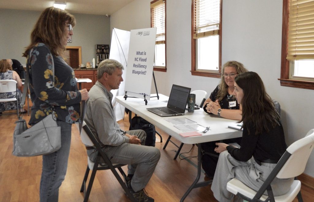
and North Carolina Department of Environmental Quality Senior Analyst Elizabeth
Christenson-Diver about flood resiliency. Photo by Lorelei Goff
Haywood County resident Melanie Burress is thankful for the public input sessions and believes they could help alleviate a problem that compounds disasters in her community of Cruso. A large percentage of her small community is elderly, and communication about events and resources is often by word of mouth, leading to misunderstandings. She points to the changes in width and depth of the Pigeon River and the silt and debris still clogging it.
“Where we live, there’s like four or five different agencies, and depending on who is larger and in charge, they will have the final say,” Burress says. “You’re sort of left going, ‘Who do I need to talk to?’ And it’s not clear.”
She hopes the blueprint will cut through the confusion of navigating multiple agencies.
For David Key with ESP Associates, a contractor assisting with the blueprint, improving communication is vital before a disaster.
“The first battle we’ve got is having people know what their risk is,” Key says. “If they know what their risk is, they can prepare, and that preparation may be understanding the weather, understanding warnings, moving cars to higher ground, moving their valuables out of their house and protecting their life.”
Limited availability of flat land can hinder flood mitigation in the western part of the state.
“The land that you can build on is in the flood plain,” Key says. “If you take away the flood plain, you take away any of the developable land. You’ve got to balance letting people live and letting Dollar General be built, with protecting the Dollar General and protecting the people.”
Additional options to achieve that balancing act, aside from buyouts and land use restrictions, include elevating homes or making massive investments to build a dam or levee, he adds. Whatever the strategies may be, he sees the blueprint being designed now as a safeguard for the future.
“In my opinion, we have a chance to do something great over the next decade because of this project, laying this foundation,” Key says.
Moving to higher ground
For one Haywood County town, building back smarter means moving part of its downtown. The idea isn’t new.
The town of Grundy in Buchanan County, Virginia, endured persistent flooding for decades, including the devastating flood event in April 1977 that killed three people and caused $15 million in damage. In the 1990s, the town’s council voted to approve a radical, $200 million plan to move the downtown area to higher ground. Now, Grundy serves as an example of effective flood resiliency.
In 2021, the town of Canton, North Carolina, incurred $18 million in damage from Tropical Storm Fred, much of that from damage to the town’s administrative offices, court building and police department.
“Just for perspective on that, my yearly operational budget maxes out around $12 million,” says Canton Town Manager Nick Scheuer.
Scheuer notes that 22 months later, some of the town’s requests for assistance haven’t made it all the way through FEMA’s application process. Completion of some projects will require a FEMA buyout. When a floodplain property is bought out, land use restrictions ensure damage and loss of life will be reduced in future floods.
He expects the town’s administrative staff and police department will remain in temporary modular trailers for another 16 to 18 months, while new offices outside the floodplain are prepared.
Canton is also installing deployable panels around historical buildings, allowing the town to create an envelope of safety around the buildings when flood conditions are forecast.
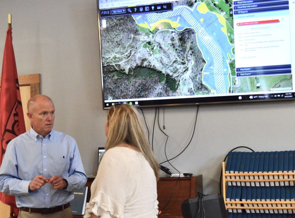
Carolina Flood Resiliency Blueprint public input session in June. Photo by Lorelei Goff
Scheuer expects the state’s Flood Resiliency Blueprint will be valuable for future planning.
“I think it’s an incredibly important process to go through,” he says, citing the ability to understand what future flooding in the community will look like and to enable the town to pursue additional mitigation strategies, such as fostering wetlands.
In Virginia, which suffered flood damage about 10 days prior to Kentucky’s July 2022 flood, a relatively new source of funding for flood preparedness is in jeopardy. If successful,Gov. Glenn Youngkin’s efforts to pull the state out of the Regional Greenhouse Gas Initiative would cut what is currently the only dedicated source of funding to the state’s Community FloodPreparedness Fund.
The Regional Greenhouse Gas Initiative, commonly known as RGGI, is a12-state cooperative that limits carbon dioxide from the power sector by imposing a cap on emissions for power generation companies. They have to buy allowances for emissions, and that revenue goes to the state. In Virginia, part of that revenue is allocated to flood preparedness.
Because that money is non-revertible and doesn’t have to be used by a certain time, the program is expected to continue operating until 2025. To date, nearly $140 million has been collected.Grants from the fund may be awarded for projects including planning, capacity building and construction. Funding Beyond that point is uncertain.
“So we, of course, are worried exactly where that new revenue source is going to come from,” says Madison Teeter, flood risk project manager with Wetlands Watch, a nonprofit that provides free technical assistance to communities for flood mitigation.
The difference between appropriated funding and the revenue stream from RGGI is like night and day, says Wetlands Watch Senior Advisor Skip Stiles.
“If you have to depend on appropriated funding, you’re competing with what the state has to spend on schools, on police, on everything else,” Stiles says.
In Canton, Scheuer says his town is emerging stronger and more resilient from the devastation of 2021.
“I think the future is bright for Canton and I think we can model what it looks like to be a resilient mountain community with a watershed flowing through our central business district,” he says. “But there’s a lot of work involved with that, and we have a long way to go.”
Related Articles
Latest News

Leave a comment
Your email address will not be published. Required fields are marked *




Leave a Comment