

Archeology Can Add Depth to Our Understanding of Blair Mountain
The following is an excerpt from a report by Harvard Ayers, Ph.D. of the Dept. of Anthropology, Appalachian State University.
The area of the Battle of Blair Mountain is being nominated under category A of the National Register criteria, as it is undeniably associated with events that have made a significant contribution to the broad patterns of regional and national history. … This case has been made from historical documentation, both from archival data and from interviews of participants and others. Significant historical events can frequently be understood not only from such historical sources, but also from data from the ground on the battle site. Such is the case with the Battle of Blair Mountain.
Over the last 15 years, field researchers have made significant findings along the ten mile length of Spruce Fork Ridge from the crests of Blair Mountain to Mill Creek Gap. The data gathered from the sites along this area clearly substantiate and corroborate the historical record. Historical sources tell us that the main hostilities were concentrated at three locations, the North and South Crests of Blair Mountain, the Crooked Creek Gap and the Mill Creek Gap. The archeological data gathered from these three areas clearly shows evidence of heavy fighting yielding limited subsurface features as well as large numbers of shell casings and unfired cartridges.
The record also tells us that areas in between these three locations were patrolled by the defenders’ sentries with only a couple of places where the miner’s forces probed the defenses, namely at the head of drainages which come off of Spruce Fork Ridge. A good example is the head of Beech Creek, recorded in the historical accounts and corroborated by limited but important archeological evidence.
But the archeological record does more than simply corroborate the historical accounts. It adds considerable depth to our understanding of the battle. Whereas the history tells us that heavy fighting occurred at the three key locations, it does not tell us much about how these areas were defended. It documents in a broad sense the number of combatants, the main types of armaments (machine guns are frequently mentioned), and the broad ebb and flow of the battles. But it does not tell us for instance, the exact locations where the defenders made their stands. It does not detail how many of what weapons were used or the likely number of combatants at the defensive positions. The archeological record for the Battle of Blair Mountain has already yielded important information that fills some of these gaps in the historical record and has the potential to add even more to our understanding of the battle with future research.
There have only been two professional field surveys of the archeological resources at the Battle of Blair Mountain, one conducted in 1991 by the Institute for the History of Technology & Industrial Archeology at West Virginia University (WVU) in Morgantown, and one conducted by the Department of Anthropology of Appalachian State University (ASU) in Boone, North Carolina, in 2006. The 1991 survey states,
“Like all great battles, the story of the Battle of Blair Mountain is best understood by seeing and traversing the actual ground upon which the battle was fought. The attacks, defensive positions, lines of supply, weaponry, etc. – the nature of the conflict—becomes clear only after the examination of the battlefield. And because of the men who died there, the battlefield is ‘hallowed ground,’ thus according it an added meaning.”
… Of the thirteen archeological sites documented by the reconnaissance surveys of West Virginia University and Appalachian State University, all are stated to have potential for yielding further important information about the Battle of Blair Mountain.
… They all have potential for yielding more important information about the Battle of Blair Mountain, and have already done so to the extent that they have corroborated the historic record and have also deepened our understanding of important aspects of the Battle. As such, they support the current nomination of the entire ten mile length of the Battle of Blair Mountain.
Related Articles
Latest News
More Stories

Signs of Life
In the Nantahala National Forest, a team of biologists spotted Indiana bats, an endangered species that hasn’t been seen in North Carolina for the last 11 years.

‘First Line of Defense’
During Hurricane Helene and its aftermath, rural fire departments and other first responder hubs played critical roles in keeping their communities safe, even without power and cut off from outside support for days or weeks after the storm. Two years later, plenty of work remains to ensure these hubs have the resources they need to operate day to day and be ready when emergencies or natural disasters strike.
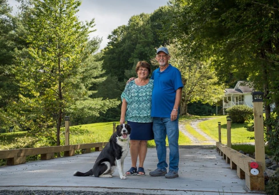
The Rocky Road — and Bridge — to Recovery
Hurricane Helene is estimated to have damaged nearly 7,000 private roads and bridges in Western North Carolina. Two years later, many restoration projects are complete, but the journey hasn’t been easy — and isn’t over for others.
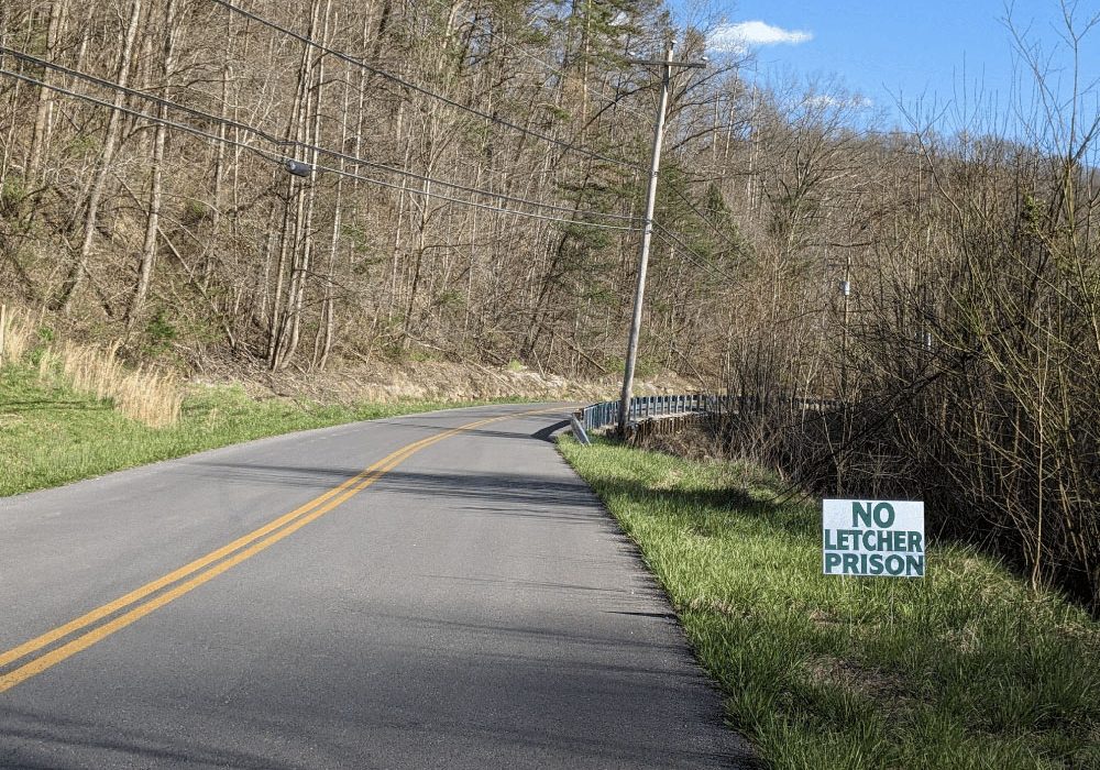
After 20 Years, Letcher County Prison Proposal Is Still Alive, Though Obstacles Remain
A $605 million proposal for a federal prison on a former strip mine site in Letcher County, Kentucky, championed by U.S. Rep. Hal Rogers, refuses to die, despite local opposition, a lack of support from the executive branch and numerous other obstacles.
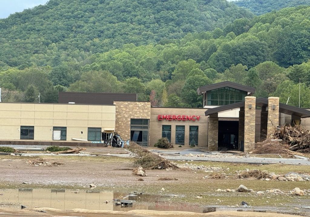
The Washout and Rebuild
For nearly two years, residents of Unicoi County, Tennessee, have had to make do without a hospital after Hurricane Helene destroyed the rural hospital. Ballad Health, which owns the hospital, broke ground on a new location — in another floodplain — in August 2026.

The Shenandoah Salamander
The Shenandoah salamander is a woodland salamander, which has adapted to life at higher elevations away from water. This sparkling rarity lives among the dry leaves, cracked logs, and stony hillocks on the highest peaks of Shenandoah National Park.

Leave a comment
Your email address will not be published. Required fields are marked *
Leave a Comment