
AV's Intern Team | February 18, 2016 | 3 Comments
By Lorelei Goff

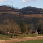
A view of Birchfield Camp Lake in June. Photo by Marty Silver, Tennessee State Parks
I arrive at the Lower Higgens Creek trailhead with a dozen other hikers, ranging from an 8-year-old to some with many miles and years to their credit. The jovial banter of Ranger Tim Pharis, Ranger Naturalist Marty Silver and State Naturalist Randy Hedgepath of Tennessee State Parks enlivens our group. This First Day hike on January 1, will take us 2.7 miles to the 100-foot Big Falls on Lower Higgens Creek and Birchfield Camp Lake, a small, man-made lake sitting at 4,000 feet above sea level.
“The name Birchfield Camp comes from the old logging camp that was up here, named after the Birchfield Logging Company,” Pharis says. “The lake was built to suppress wildfires.”
After large-scale logging operations ceased in the 1960s, the 10,000 acres of the Cherokee National Forest known as Rocky Fork remained undeveloped. A decades-long saga, rife with drama and even some intrigue between private sector developers and an alliance of government agencies and activists, ended in 2012 with the land secured for public ownership and enjoyment within the Cherokee National Forest. Rocky Fork State Park, now in development, occupies 2,000 acres of Rocky Fork in Unicoi County, Tenn. The remaining 8,000 acres span portions of Unicoi and Greene counties.
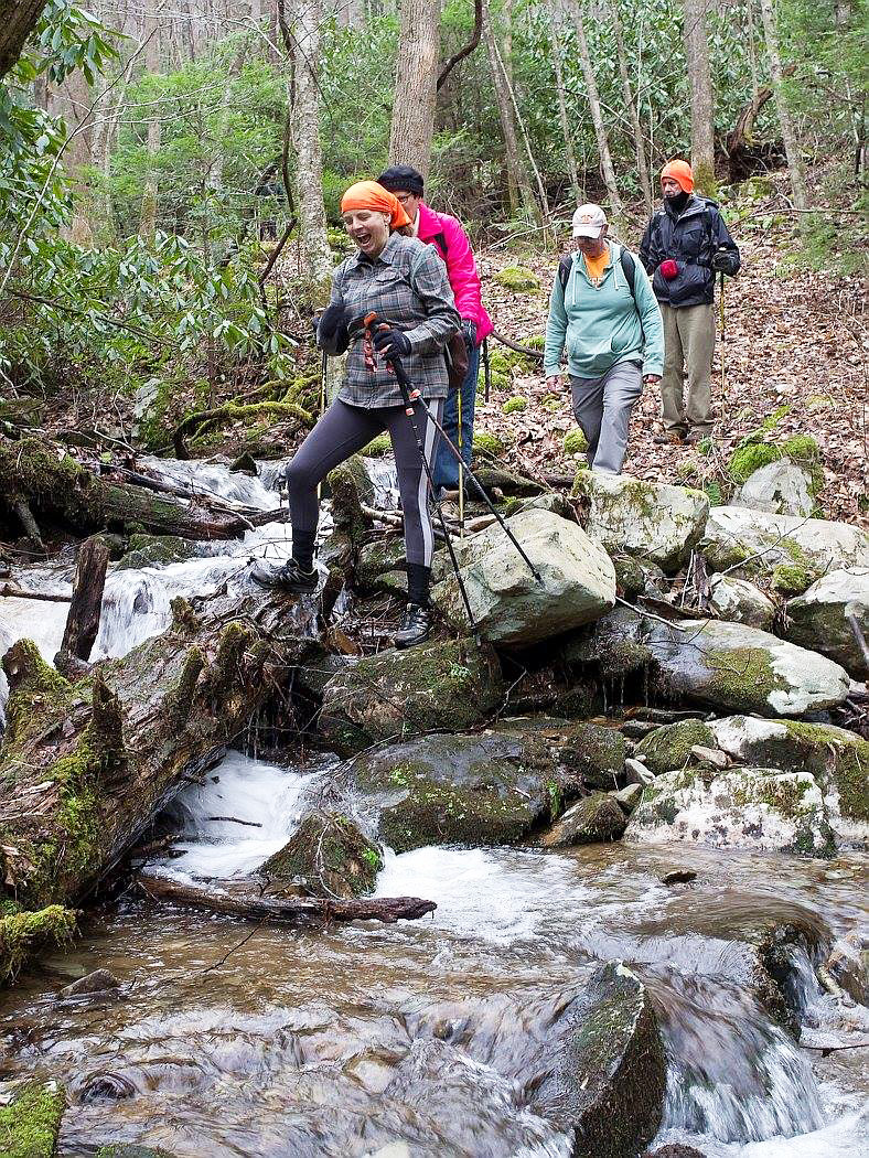
Hikers willing to ford the trail’s creek crossings. Photo by Marty Silver, Tennessee State Parks
We start up the remnant of an old logging road, coming to a gravel parking area after about a third of a mile. Hedgepath spots a putty root, a wild orchid with pin-striped leaves. It was traditionally used to seal windows, he says. According to Ranger Silver, Rocky Fork harbors several unique species of orchids and rare trilliums, around 80 species of mosses and liverworts, and rare salamanders including the Yonahlossee, a large, black salamander with a distinctive rusty blotch on its back.
Roughly a mile into our hike, the sound of flowing water grows to a roar and we stop at Big Falls. A steep but short path drops off dramatically to the right, descending to the foot of the falls. The recent rains have swelled the normally tame 100-foot cascade into a foaming cataract. Most of the group makes their way down the slippery path with the help of a safety line secured from top to bottom. We take pictures amid the spray, then climb back up to the trail.
We make the first of several creek crossings a short distance later. After the second creek crossing, the trail veers from Lower Higgens Creek and follows Birchfield Camp Branch, fed by the lake above.
The mood is mirthful, despite the dropping temperature. After more creek crossings, we ascend the steepest segment of the trail and come upon the rusted bones of an ancient logging truck. We explore its remains wondering how it met its demise between the trail and the creek.
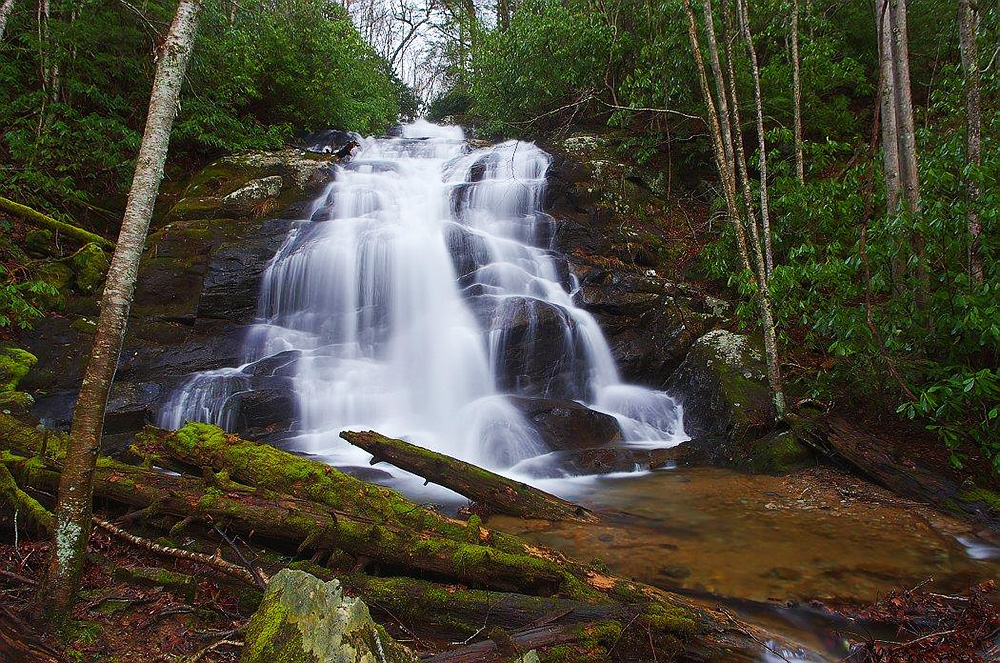
The big waterfall on Lower Higgens Creek. Photo by Marty Silver, Tennessee State Parks
The creek sliced through the mountain long before loggers cut a road alongside its path, so narrow that it’s hard to imagine logging trucks descending with their pillage.
The last stretch takes us past a couple of caves to the right and then we see the lake, surrounded by white pines and mountain laurel. It’s small, but the beauty of the scene is augmented by the exhilaration of reaching it. Rumor has it that it’s a popular dining area for local bears, with frog legs being a favorite dish. We all sit down to dine on our lunches, and some stroll along the .75-mile loop around the lake. No bears in sight, just a lone turkey hunter ambling through. On a warmer afternoon, it would be hard to leave, but a raw chill is seeping through our layers and there are some wet feet from crossing creeks. We head back down the trail in the waning light of 2016’s first day.
Difficulty: Moderate to strenuous with some challenging creek crossings
Details: 5.4 miles round-trip. Wear high boots, gaiters and bring extra socks
Directions: From I-26, take exit #43. Turn right onto 19/23. After .75 mile, turn right onto Lower Higgins Road, which will end at a small parking area. Groups can park at the I-26 Welcome Center and carpool.
Contact:Contact Rocky Fork State Park: 423-271-1233, tnstateparks.com and Cherokee National Forest, Watauga Ranger District: 423-735-1500, fs.usda.gov/cherokee
More info: “Rocky Fork: Hidden Jewel of the Blue Ridge Wild,” a book by local conservationist and photographer David Ramsey, will be available in spring 2016 through daramseyphotography.com
Like this content? Subscribe to The Voice email digests
2016 — (Feb/March)
 Community celebrates opening of new recreation area in Dante, Virginia
 How a Pipeline Proposal Birthed a Community Movement in Middle Tennessee
 Tennessee enacts law halting efforts to take over surface mine regulation from federal government
 Nuclear Company Pursues Plans to Refine Uranium in Erwin, Tennessee
 ![]()
![]()
![]()
![]()
![]()

The Appalachian Voice is a publication of Appalachian Voices
589 West King Street, Boone, N.C.
© 2021 Appalachian Voices


 Member Spotlight: Russ Moxley
 Volunteer monitors coal mine data and maintains Appalachian Trail
 Creating Positive Change: A Note from Our Executive Director
 Solar, Environmental Justice and Utility Reform in Virginia
 Engaged activists get bipartisan wins in 2024 General Assembly session
 Investing in what matters: Federal funding to kick off community-led resiliency projects
 Opposition to new Dominion gas plant grows — and now includes Virginia state legislators
Great article…Marty Silver has done so much at Warriors Path in Kingsport !
Rocky Fork, now a State Park.. is a product of the protracted efforts of many Agencies, Land Trusts, individuals and, yes, politicians!
I am very proud to say that the nucleus and nexus of the effort lay with David Ramsey, Southern Appalachian Highlands Conservancy ( land trust) Board member and SAHC which generated the energy and coalition which protected this priceless treasure; only $40 million worth of ecologically and recreationally invaluable diversity.
Stay tuned for David’s book on RF; he is also a professional photographer of some reputation.
Thanks for recognizing Rocky Fork; it was scheduled for sale to become a gated community of million dollar homes, btw.
As a past SAHC Bd member and ongoing member of the Land Protection Committee, protection of RF and its value to our future generations gives me hope for the future as does the fine efforts and results AV produces…
Really should stay as a natural reservoir, never to be touch by the human hands please keep the area free from builders
“so narrow that it’s hard to imagine logging trucks descending with their pillage”…..if it wasn’t for the loggers there wouldn’t be any access roads. Trees are a renewable resource.