
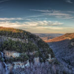
Spectacular views at Cloudland Canyon State Park
Kevin Ridder | December 16, 2019 | No Comments
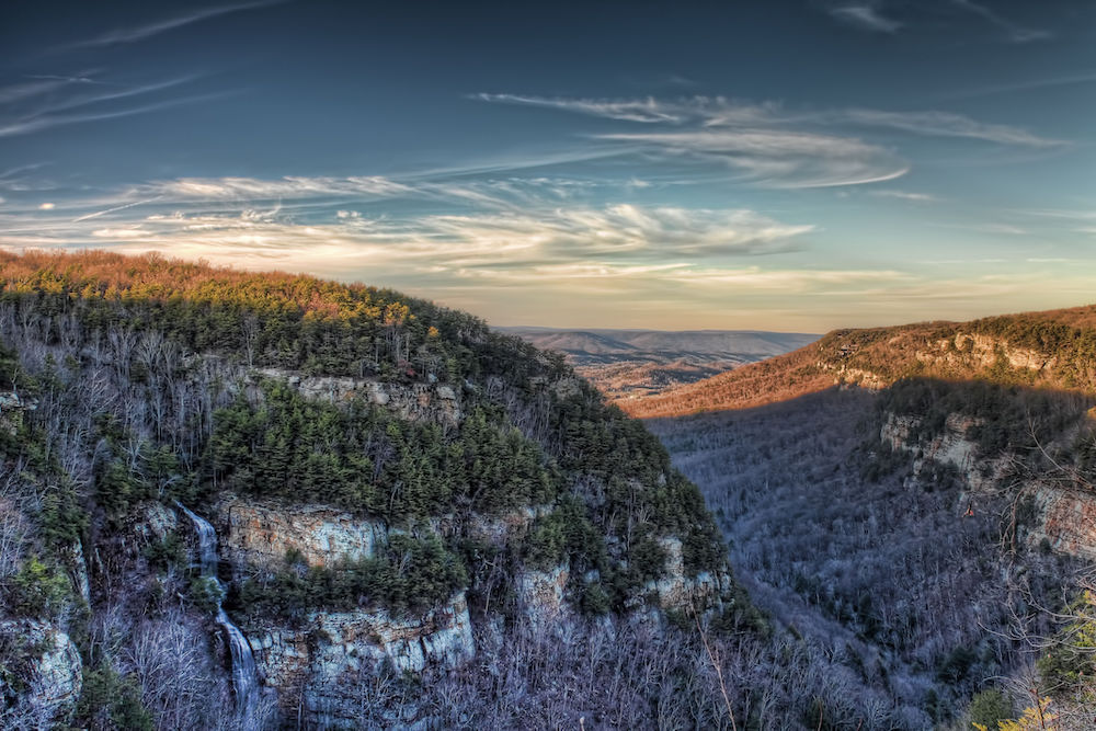
A view of Cloudland Canyon from the main trailhead on a clear winter day. Photo by Chris Appugliese
Established in 1938, the park is located in the corner of Northwest Georgia, about a 30-minute drive from Chattanooga, Tenn. Steep cliffs transition into gently sloping hills, blanketed in October’s green- and autumn-tinted tree canopy, and the Blue Ridge Mountains outline the horizon. While some green will remain in winter, most of the valley’s trees will lose their leaves until spring returns. It’s a very popular destination in fall and winter.
LENGTH: 4.8 miles round-trip
DIFFICULTY: Moderate to strenuous
DIRECTIONS: From U.S. I-59 South, take Exit 11 for GA-136 toward Trenton. Turn left onto White Oak Gap Rd. and right onto S. Main St. after 0.3 miles. After 0.1 mile, turn left onto Lafayette St. for 6 miles and turn left at the state park entrance. Follow signs to the main trailhead.
FEE: $5 for a one-day parking pass
CONTACT: Call (706) 657-4050 or visit gastateparks.org/CloudlandCanyon
OTHER NOTES: Check ahead of time for any winter-related trail closures. Hikers with dogs must keep pups leashed and clean up after them. Wear sturdy shoes and allot at least three hours for the hike.
The 3,538-acre park boasts scenic waterfalls, natural caves, dense forests, numerous hiking and mountain biking trails and a variety of overnight accommodations including campgrounds, backcountry sites, cabins and more. The thousand-foot-deep gorge at the center of the park showcases millions of years of erosion powered by Bear and Daniel creeks.
Murdock tugs us away and we begin our trek along the West Rim Loop Trail. Glancing at a map, we see that the 4.8-mile hike descends into the thousand-foot deep canyon and back up to the other side, where it loops around the west canyon walls before retracing the last mile back to the trailhead. Signs near the overlook warn hikers not to throw rocks over the edge, as they might strike others below.
We shortly come upon the first of several metal-grated staircases, which may present a challenge for dogs. About a quarter-mile in, the trail splits off into the West Rim Trail and the Waterfalls Trail. The latter involves roughly 600 stair steps down, but rewards hikers with the sights and sounds of Cherokee Falls and Hemlock Falls.
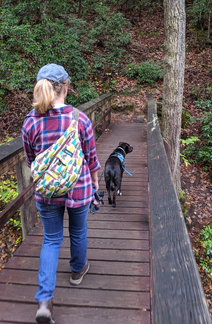
Hikers Courtney and Murdock. Photo by Kevin Ridder
I pause momentarily to peer inside a natural cave near the rim. A pleasant, woody smell lingers in the air after the morning’s rain. The trail narrows at this point and there is a steep cliff to the right, so we tread carefully. We soon hike past the park’s yurts, which travelers can rent for the night year-round.
Reaching the rim, we enjoy the flat portion of the trail. A sign tells hikers to stay on the trail to protect vegetation. Even though you might not see much green in the colder months, there are many wildflower species in the area that are visible come spring. Venturing off-trail can kill plants, increase erosion and compact the soil.
About a mile into the hike, we suddenly step out onto a large slab of rock where we can see the first overlook on the other side of the canyon. After a quick break for water, we dive back into the trees and follow the yellow blazes.
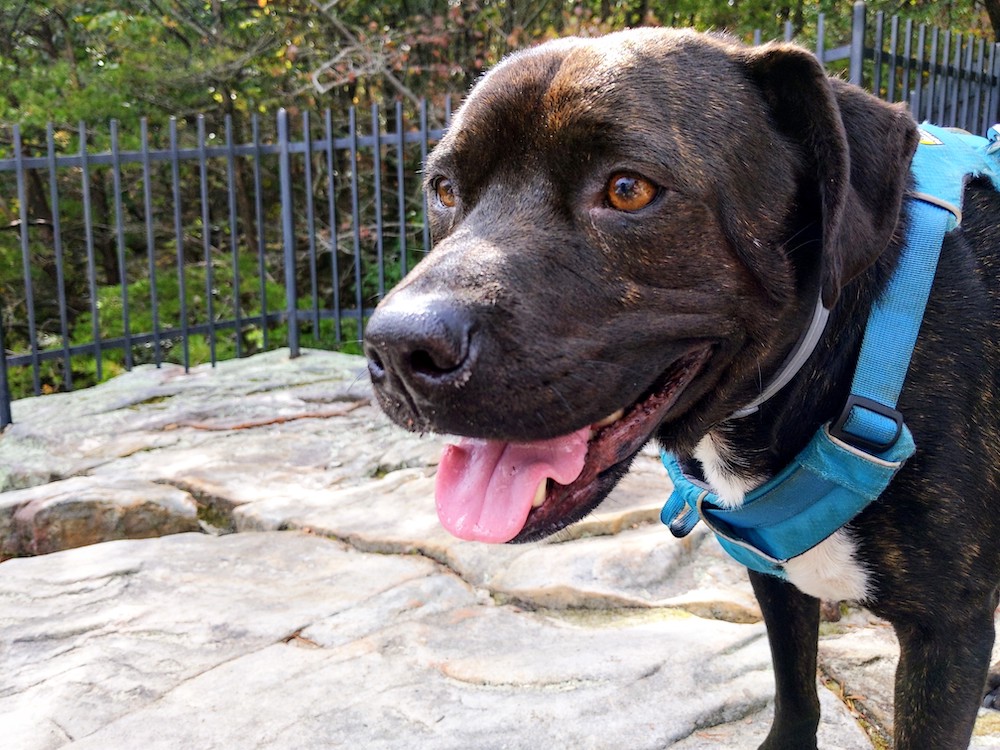
Fellow hiker Murdock. Photo by Kevin Ridder
Our gradual ascent along the grassy path crosses a park road about two miles in. We reach the northern edge of the canyon’s rim and veer right to follow the trail. After several smaller overlooks, Courtney and I reach a stone staircase that leads down to a fenced area where we are met with a spectacular view of the canyon and Lookout Mountain to the north. A sense of quiet wonder sets in as we stand and take in the landscape.
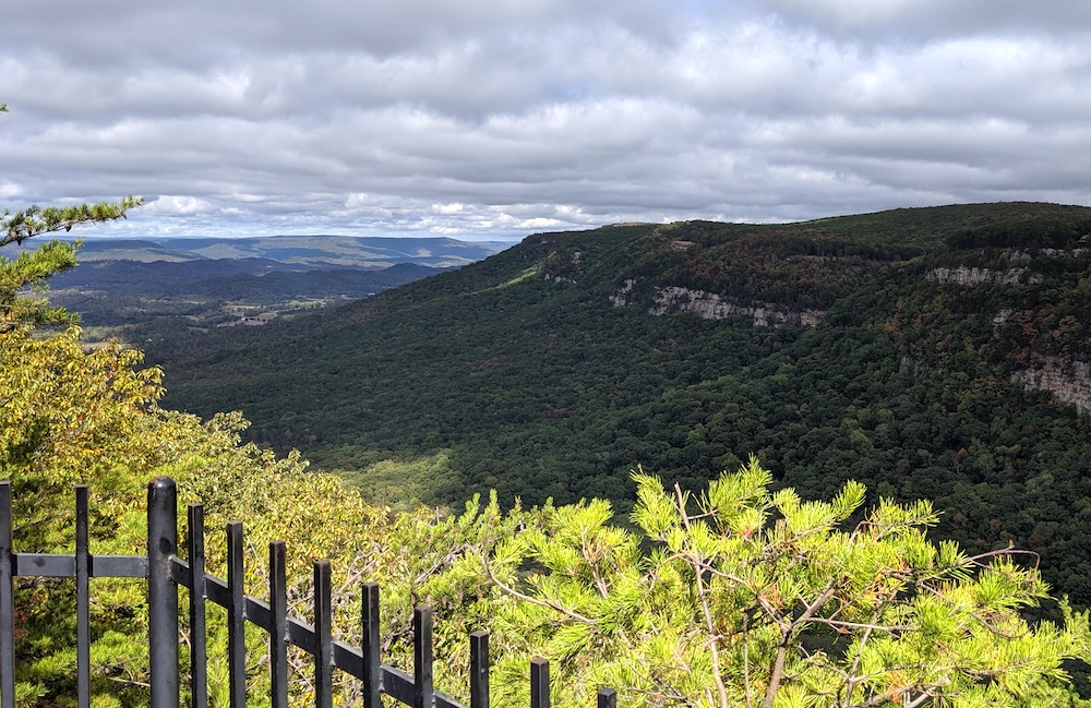
The view from a fenced-in overlook on a cloudy day. Photo by Kevin Ridder
At roughly 3.5 miles, we complete the loop and begin retracing our steps with Murdock in the lead. We dip down into the gorge and back up again, returning to the trailhead at 4.8 miles. Pausing one last time at the first overlook, I wonder what the park will look like when winter comes to the mountains. I hope to return soon to see it for myself.
Like this content? Subscribe to The Voice email digests
2019 – December/January

 Investing in what matters: Federal funding to kick off community-led resiliency projects
 Opposition to new Dominion gas plant grows — and now includes Virginia state legislators
 Duke Energy’s proposal to convert the Roxboro coal plant to gas would be one of many dangerous new fossil fuel investments
![]()
![]()
![]()
![]()
![]()

The Appalachian Voice is a publication of Appalachian Voices
589 West King Street, Boone, N.C.
© 2021 Appalachian Voices


 Member Spotlight: Russ Moxley
 Volunteer monitors coal mine data and maintains Appalachian Trail
 Creating Positive Change: A Note from Our Executive Director
 Solar, Environmental Justice and Utility Reform in Virginia