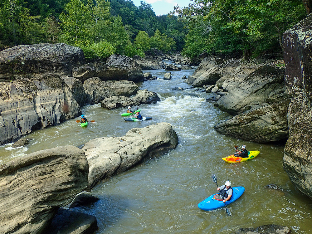
When Lake Cumberland is low and the Rockcastle River level drops, the beauty of the Narrows section shines. Kayakers that know of this Kentucky gem rally when conditions are ideal, not batting an eye at hiking their boats and gear close to a mile to the put-in. Photo by Brandon Jett
The Rockcastle River (pictured on the cover of this issue) flows through portions of Jackson, Rockcastle, Laurel and Pulaski counties in Kentucky.
How to access: The put-ins and take-outs for different sections are located along roads and bridges, with the access points visible from the roads. Visit
tinyurl.com/rockcastle-river.
Difficulty: This river is divided into Upper and Lower Rockcastle, each nearly 17 miles long. Upper Rockcastle is Class I+ and okay for beginners, while Lower Rockcastle has Class III to IV rapids and is only recommended for the experienced and well-equipped.
Fun Facts: Rockcastle River gets its name from the 100-foot-tall cliffs that tower above it, especially through the Narrows, a gorge running through the lower section. The state has designated the Narrows as a Kentucky Wild River, which means 2,000 feet on either side is protected from certain activities like clearcutting.
Local Champion: The Kentucky Waterways Alliance is a statewide organization committed to protecting, restoring and celebrating the state’s waterways. The group’s Rockcastle River Conservation Program aims to conserve the land and species surrounding the river. To learn more, visit
kwalliance.org.
More info: The U.S. Forest Service,
the Kentucky Department of Fish and Wildlife Resources, and
American Whitewater have detailed webpages on the Rockcastle River that provide directions, descriptions of rapids, outfitter recommendations and more. — Sam Kepple
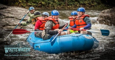
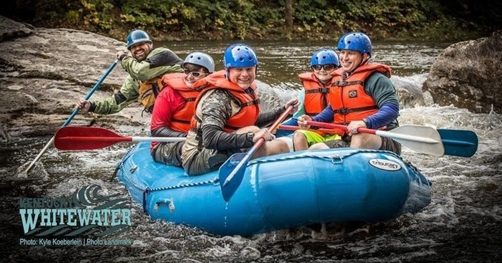
Guided raft trip on the Russell Fork. Photo courtesy of Kentucky Whitewater
Russell Fork is part of the Big Sandy River basin and flows from Dickenson County, Va., to Pike County, Ky.
Difficulty: The Russell Fork is best suited for advanced paddlers, who flock to the area during dam releases. The top section is Class II to IV, the gorge is Class IV and V, and the lower section contains several Class III rapids. Guided rafting trips offer another way to explore the river.
How to access: American Whitewater offers detailed directions to put-ins and take-outs.
Fun Facts: In Breaks Interstate Park, the Russell Fork forms the deepest gorge east of the Mississippi River.
Local Champion: For years, local paddlers have advocated for more frequent releases from Flannagan Dam. The U.S. Army Corps of Engineers traditionally allowed recreational dam releases during October weekends only, but in 2018, the Corps extended the fall dam release season by two weekends. Jason Foley of Kentucky Whitewater, an Elkhorn City outfitter that runs trips on the Russell Fork, expects the Corps to decide this summer whether to extend the October release weekends to include more days. Ultimately, Foley and others want to see Congress and the Army Corps expand the Flanagan Dam’s official project purpose to include downstream recreation, and he encourages paddlers to contact the Corps’ Huntington District office.
More info: For the latest paddling conditions and updates on dam releases, search the Russell Fork on the American Whitewater website, or visit
russellfork.info. — Molly Moore
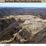 New report shows alarming lack of mine cleanup progress in Kentucky
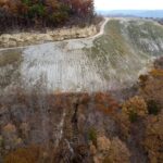
 Reclaiming Appalachia Coalition report shows how mine cleanup can boost local economies
 Final Stage of Blue Grass Chemical Weapons Cleanup Underway
 Online tool helps track status of mine ownership in aftermath of Blackjewel bankruptcy


 Member Spotlight: Russ Moxley
 Volunteer monitors coal mine data and maintains Appalachian Trail
 Creating Positive Change: A Note from Our Executive Director
 Solar, Environmental Justice and Utility Reform in Virginia
 Engaged activists get bipartisan wins in 2024 General Assembly session
 Investing in what matters: Federal funding to kick off community-led resiliency projects
 Opposition to new Dominion gas plant grows — and now includes Virginia state legislators